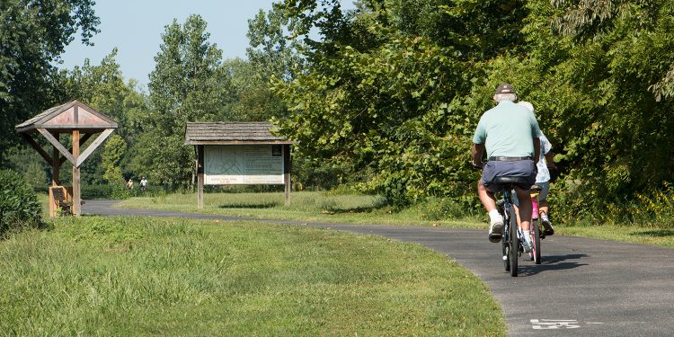
It’s been a long time coming, but with the connection along Southtown Boulevard completed, the Greenbelt is now a continuous 15 mile multi-use trail around Owensboro. Specifically, it’s a 10 foot wide asphalt surface that meets the Americans with Disabilities Act Standards. On any given day, hundreds of Owensboro residents enjoy walking, running, skating, or bicycling along the greenbelt.
[tw-divider]Access[/tw-divider]
For easy access, there are designated parking areas at the GRADD on East 60, the trailhead at the end of Higdon Road, Higdon Yewell-Heritage Park in Hillbrooke subdivision, and the trailhead on Miller’s Mill Road. Jack C Fischer Park, Kroger Starlite, Shifley Park, and the Dairy Queen on 231 are also good places to park if you’re just wanting to use a section of the trail.
[tw-divider]Planning Your Route [/tw-divider]
The entire Greenbelt is a little over 15 miles one way, so an out-and-back makes a great 30 mile bike ride. It’s actually a very pretty route. Along the way you’ll parallel the bypass, cut through some neighborhoods, pass through a couple parks, cross a few creeks, and you might even see some animals off in a field. For a 15 mile ride or run and you’ll need to leave one vehicle at GRADD and one at the Miller’s Mill Trailhead.
If you’re looking for a good 5K route, try starting at Miller’s Mill trailhead and going to the wooden walkway at Yewell Heritage Park (1.7 mi) and back. For a nice 10K route, start at the other end, from GRADD to just past Bittell Road and back.
For a 10 mile route, use the “Horse Fork Creek” section. It’s 4.3 miles, so start at Miller’s Mill Road and turn around one mile past the Higdon Road Trailhead (almost to J.R. Miller) and backtrack.
Miller’s Mill road to Jack C Fisher Park is roughly 13 miles, so that’s an easy way to get a 13.1 (half marathon) route. And of course the return gives you a full marathon route.
A water fountain is provided at the Higdon Road Trailhead. You could always stop and buy a drink at Dairy Queen on 231, Huck’s on Southtown, the Shell Station at Tamarack & Carter, or Kroger Starlight.
So do your heart and your soul a favor – get out and enjoy the greenbelt. Further information and a trail map can be found at www.owensboroparks.org
[tw-divider]Additional Info[/tw-divider]
- The next project for the Greenbelt is connecting the spur from Chautauqua Park through the Heartland Subdivision to connect at Yewell Heritage Park.
- Mile markers are another nice addition. Painted every ¼ mile, the markers help you know how far you’ve traveled, but more importantly they can be used to identify your location in case of an emergency.


